
By Lance Hodgins
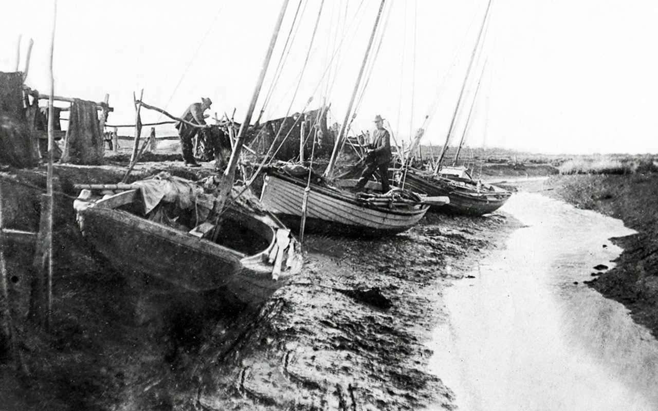
The fishermen looked up from checking the nets they had hung out on the rails along the banks of Kings Creek. A wagon with a small party of men on horseback was coming down the track from the direction of Bunguyan and it didn’t look like any of the King family. The leading rider swung down from his mount and introduced himself.
“Michael Callanan,” he announced in a broad Irish accent. “I’m the government surveyor. We’ll be with you for the next few weeks.”
With that, he motioned his men to a small clearing nearby and they began to erect their tent. The fishermen watched on with interest as Callanan unpacked his equipment. Some of them had seen the maps made by Robert Hoddle at the time of the Melbourne land sales and marveled at their accuracy and neatness.
Since then the colony of Victoria had been created with a Lands Department and Captain Andrew Clarke, ex-Royal Engineers, as the first Surveyor General. His task was to come up with a plan to develop the future settlement on the lands of Victoria. This involved the transfer of grazing land, almost entirely under the control of big squatters, to the people who needed to farm it. This meant that 23 million acres would have to be explored, surveyed, measured and mapped out.
The man in the tent
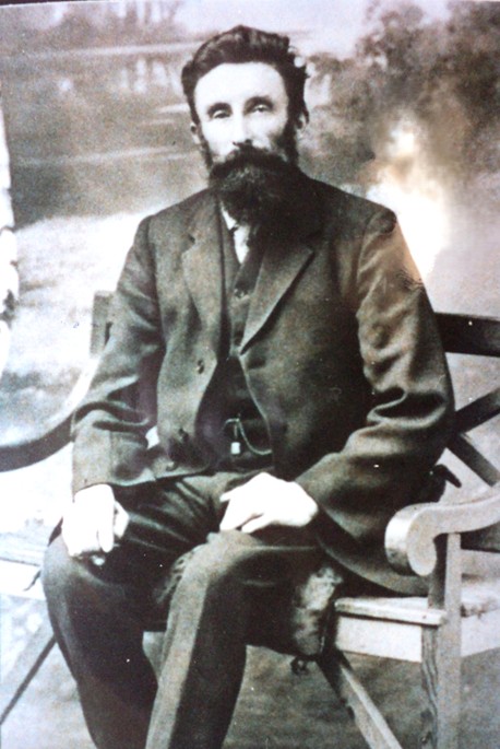
Michael Callanan was just the man for the job. Born in Ennis, County Clare, Ireland in 1830, he completed his surveyor’s training and migrated to Australia at the age of 24. Within weeks he had entered the public service under Captain Clarke.
Callanan was a sturdy and independent type who refused to be bound by departmental red tape or be influenced by wealthy land-grabbers. He was determined to see that every man received a square deal and have the opportunity to carve out his own future unhampered by unfair competition.
He started at Werribee and four years later, by 1858, he had moved on to Western Port. By then he was getting used to life in a tent – which was just as well, as he had 13 more years of it to come.
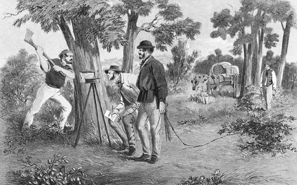
Callanan and his crew set to work at first light. A six feet long log was driven two feet into the ground as a starting point, and a nearby tree was “blazed” and had Roman numerals of the lot number cut into it in case the stake was lost.
A circumferenter (compass) was mounted on a tripod and used to determine the direction of the lot boundaries and their relation to magnetic north. Trenches were then dug to indicate the direction of these.
Out came Gunter’s chain – a series of 100 links measuring a total of 66 feet, or “one chain”.
It was invented by an English clergyman and mathematician almost 300 years earlier. Based on the breadth of a plough strip, the “chain” had become the legal measurement for land and the basis for government maps – as well as the length of a cricket pitch.
From the starting point stake, the chain was dragged out to its full length and another stake placed at the end of it. This was continued until the desired amount of land had been surveyed.
All sorts of difficulties were encountered, from trees and scrub to waterways and swamps, not to mention the distortions created by rises and falls in the landscape.
The chainman worked under the direction of the surveyor, who meticulously recorded the details and directions in his notebook. Comments on vegetation and soil types were also recorded, all to be transferred to a map that evening in the confines of his tent.
These plans became the basis for the government’s maps which controlled the issue of title deeds and leases to the people of Victoria.
‘Tyab’ (now Tyabb) is on the map
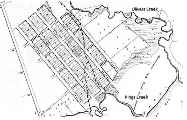
Callanan’s survey marked out a future township which he named “Tyab”, according to the local government parish of the same name. It seemed a good site – on gently sloping land between two creeks, Kings and Olivers, and overlooking Western Port.
The would-be township sat on each side of the main track leading down to Western Port. Callanan marked it out on paper with streets and almost 200 half-acre allotments on a beautiful grid pattern reminiscent of Hoddle’s Melbourne.
After Tyab, the Nicholson Land Act (1860) opened up 400,000 acres of Victoria for the people, followed by the Duffy Land Acts of 2 million acres in 1862 and another 2.3 million acres in 1865.
Callanan was extremely busy. He moved on to Gippsland and didn’t return to Melbourne until 1870 where he subsequently became Surveyor-General, finally retiring in 1895.
He was a foundation member of Melbourne’s Celtic Club, which celebrated Irish heritage, and he was a generous supporter of Ireland’s national cause. He died at 90 in 1920.
In 1858 Callanan and his government had indeed provided for a settlement at Western Port.
The Callanan legacy
The earliest purchasers came from the fishermen who had camped on the banks of Kings Creek: Gilbert Perriam, William Bryant, James Stirling, Hugh Tulloch and James Mitchell. James Barclay already lived nearby, having bought land on Olivers Creek on its eastern edge.
It wasn’t long before some facilities for a settlement emerged.
On February 24 1862 six acres of Crown Allotment 76 was reserved as the site for the “Tyabb Cemetery” – named in anticipation of the town. In December 1865 the cemetery trustees were appointed: James Hall and William Lawson Patterson, both early purchasers in Tyab, John O’Neill of the Bunguyan homestead, and Anthony Spencer, a farmer on Denhams Road.
A few months later, on 6th May 1866 they received their first burial – a local fisherman by the name of Alexander Mackay.
By the mid-60s, a home in Tyab was being used as a church with up to thirty Church of England worshippers meeting there regularly. It sat on the corner of King, Wright and Lyall Streets on lots 1,2,3, and 4 – two acres almost opposite the road to BlueScope where a service station and car yard are today.
Before Callanan’s survey, in 1855 John and Ann Norris travelled overland from Melbourne to their block of land at Kings Creek which they had “purchased” at the shipside. They pitched their tents under a big old gum which John used later in the building of a house. As well as being a carpenter and shipwright, John was a devout Protestant and he built wooden brackets to hang from the ceiling, each holding a dozen candles. He also brought down from Melbourne a ship’s bell which acted as a call to worshippers and he played for the services on his Stradivarius violin.
The building was also used as a schoolroom. Registered as “Tyabb no.73” it operated throughout the 1860s and, being the only school in the district, it maintained an average attendance of at least twenty children.
After Callanan pronounced his new township, Norris moved to a larger property of 20 acres further north. He was joined there much later, in 1885, by his son-in-law Jasper King, who cared for him in his twilight years.
Norris preferred to sit quietly beside the fire at his small kitchen window and quietly read his Bible. He passed away in 1888 aged 84 years.
His former home which had served as a school and church became officially designated as a “Crown grant” to the Church of England and was sold when a new church was built on the other side of the creek.
Tyab stalls
The house which had served so efficiently as a home, church and school was not enough to guarantee the success of Callanan’s town. Very few of the fishermen bought lots there and it remained as silent as the new cemetery. Its lack of success, and Callanan’s reputation, were summed up by one critic:
“As usual, when the population is in the process of LEAVING a neighbourhood, the government sets about surveying a township. Consider for example the one at Tyabb – NOT the private one on the most eligible site beyond – but the government one which consists of two houses – AND ONE OF THEM IS UNOCCUPIED.”
Callanan, however, had a much larger problem than receiving such comments: he didn’t know what to do with the fishermen’s cottages that were strung out along the coast at Star Point, one mile further south.
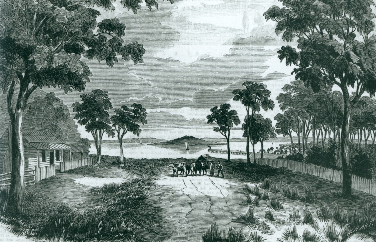
A part of Section 53 of the Land Act gave fishermen the right to occupy Crown lands for the purpose of building residences and drying nets. As a result of this “Fisherman’s Right”, many began to settle on the water’s edge around the shores of Western Port. This was most evident at Star Point where houses and huts were scattered along a track built beyond the saltwater marsh and just clear of the high tide line.
Callanan’s solution to this problem was to simply ignore it and he omitted the entire 25 acres at Star Point from his survey. Of course, this left the fishermen there literally in no man’s land; when their leases expired the following year, they would have no tenure over their properties and this unfortunate situation would remain for over a decade.
Tyab might have had a school, a church and a cemetery but the building blocks were empty. Things were already happening on the other side of King’s Creek.
This is a chapter from “Fish Town – Hastings, the first 50 years”. Copies of the book may be obtained for $40 from the author: Lance Hodgins 0427 160 892.
Peninsula Essence June 2026